There is no better way to explore the River Ouse and the history of the Bedford area than by canoe or kayak. It allows you to sample the living history at a peaceful pace.
The river has been important for navigation, and for draining the low-lying region through which it flows. Its course has been modified several times and was first recorded in 1236, as a result of flooding. During the 1600s, the Old Bedford and New Bedford Rivers were built, to provide a quicker route for the water to reach the sea.
Improvements to assist navigation began in 1618, with the construction of sluices and locks. Bedford could be reached by river from 1689. With the coming of the railways, the state of the river declined, so that is was unsuitable either for navigation or for drainage. The navigation was declared to be derelict in the 1870s.
There was significant sugar beet traffic on the river between 1925 and 1959, with the last known commercial traffic occurring in 1974.
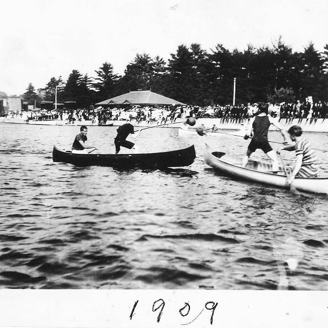
Leisure boating had been popular since 1904 and Canoe Trail is proud to be part of this Paddling revolution.
The river was re-opened to Bedford in 1978 and is now managed by the Environment Agency. The 1978 reopening of the River Great Ouse to the coast led to the inaugural Bedford River Festival. This event is now the 3rd largest event in Europe hosting over 350,000 visitors over the weekend. Canoe Trail has organised the watersports activities for much of the River Festival since 2006.
Cardington Artificial Slalom Course located in Priory Country Park, 2.5 km downstream of the town was opened in 1982 and was the first whitewater course of its kind.
Source and Route of the River Great Ouse
The river has several sources close to the village of Syresham and Sulgrave in Northamptonshire. It flows through Brackley, Buckingham, Milton Keynes at Stony Stratford, Newport Pagnell, Olney (there is no river access on all stretches above Bromham and hence this is not part of the canoe trail) and Kempston, which is the current head of navigation for larger craft.
Passing through Bedford, St Neots, Godmanchester, Huntingdon, Hemingford Grey, and St Ives, it reaches Earith, where there is a short tidal section connected by the Old Bedford River and New Bedford River to the lower river at Denver. The old course of the river passes through the cathedral city of Ely and Littleport, to reach the Denver sluice. Below this, the river is tidal and passes Downham Market to enter The Wash at King's Lynn.
An Act of Parliament was passed in 1600 which allowed Adventurers, who paid for drainage schemes with their own money, to be repaid in land which they had drained.
There is a large number of historic bridges, locks, sluices, and other engineering locations along the route of the canoe trail. Interesting features you can see on your trip include:
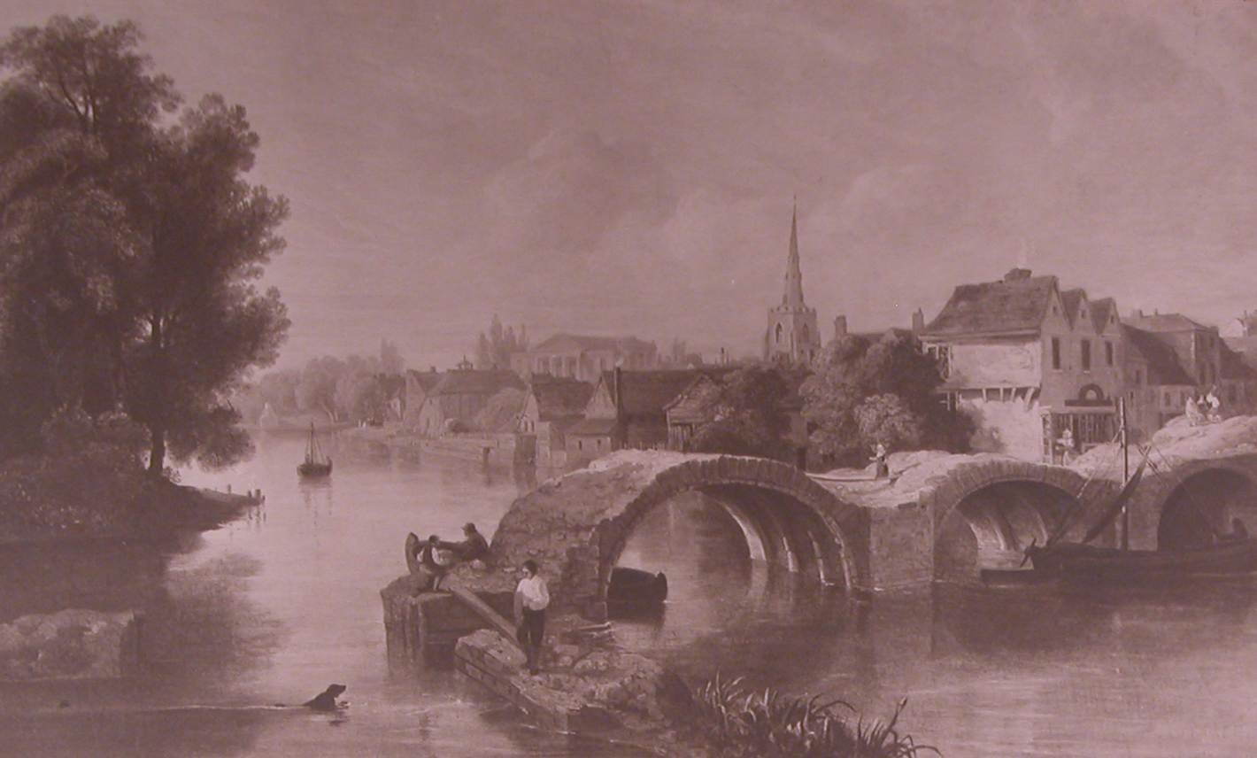
Bromham Bridge
The first historic references to this large 26 arch bridge spanning the river between Bromham and Bedford were in 1224. The current stone structure was rebuilt in 1813. The first known reference to it is in the Pipe Rolls for 1224 and again in 1227/8 where a piece of land is noted as bounding "Wuluescroft towards the bridge of Biddenham", an adjoining cottage was occupied by Hugh de Ponte. The original bridge was washed away in the floods in 1281. Don’t worry the current bridge seems pretty solid!
Bromham Mill
This is now run by the local council and is a great place to visit for tea, cake, and food. It hosts local artists and artisans including photos and arts and crafts for sale. It is open from Friday to Sunday and accessible from the Bromham end of the bridge. The Mill is thought to be the late 18th Century and originally had 2 waterwheels, one of which was restored in 1980.
Kempston Mill
Now converted into modern flats located just below Kempston Weir the mill was originally listed in the Doomsday Book in 1086, owned by Countess Judith. During the recent conversion archaeologists also found Roman ruins suggesting a mill at the site even earlier. it is 72 miles from Kempston to The Wash.
Bedford Town Bridge
Bedford Town Bridge signals the start of Bedford’s iconic embankment with its stone blocks and impressive features. It is pedestrian and road traffic now and sits at the bottom of the High Street on St Paul’s Square. Bedford was originally built on a ford through the River Great Ouse which developed into a wooden structure. The current bridge was designed in 1813 by John Wing and originally had a chapel on the bridge itself. It was widened in the 1940s.
Bedford Castle
As you enter the Bedford Embankment you will see the rebuilt castle mound which also leads to the Cecil Higgins Museum Behind. It was originally built by Henry I and belonged to the de Beauchamp family for most of its time. The scene of one of the most bloody sieges after it was seized in the early 13th century by Falkes de Breautae, a henchman of King John. A royal army was mustered and the Castle was raised to the ground in 1224 after a siege lasting 6 weeks.
Bedford’s Victorian Embankment
Bedford’s Victorian Embankment was created by the Victorians as a tree-lined promenade with the River as the jewel in the crown. As part of this, the river route was diverted to form the straight banks and islands you see today. The pedestrian suspension bridge (built by Webster) linking the Mill Meadows island, located towards the bottom of the embankment, was opened in 1888, and shortly after the bandstand also located on the island.
Baptism of John Bunyan
John Bunyan, author of Pilgrim’s Progress and was baptized in the River Great Ouse in 1653 in a quiet backwater. This is located on the lower river adjacent to the Etienne Stott Whitewater Arena. There is a commemorative plaque at Duckmill Weir.
Etienne Stott White Water Arena
Located on the lower River in the town center the Etienne Stott Whitewater Arena was named in honour of Viking Kayak Club’s and Bedford’s Olympic Champion in Canoe Slalom at London 2012. The white water arena is operated by Viking Kayak Club, the town’s award-winning kayak club on the site formerly and also known as Duckmill Weir.
The Butterfly Bridge
The newest addition to the Bedford Embankment is the Bedford Butterfly Bridge located adjacent to the Longholme boating lake. A competition was held by RIBA (Royal Institute of British Architects) to chose a suitable bridge crossing to keep with the historic bridges built over the centuries. Wilkinson Eyre's double-arched cable-stayed bridge was unanimously chosen as the first prize winner by the Jury Panel from 79 entries. It was opened in November 1997 and has been an iconic landmark ever since. For Canoe Trail we use it as the endpoint for our Bromham to Bedford half-day paddle.
Bedford Boating Lake
Bedford’s Longholme Boating Lake was donated to the town in 1923 as a result of the generosity of the Rotary Club and its members. Ever since it has been a great tourist attraction facilitating boating on the Great Ouse. Nowadays it provides Viking-styled rowing boats, traditional rowing boats and canoes, and kayaks from Canoe Trail.
Archimedes Screw Hydro Power Scheme
Located at the site of an old Victorian boat slide adjacent ‘Schools Weir’ the local council installed a hydropower plant which was officially opened by Mayor of Bedford, Dave Hodgson on 18th June 2012. The Archimedes Screw is targeted to produce 133,000 kWh of green energy each year.
Cardington Artificial Slalom Course
Cardington Slalom Course was the first of its type in the current and is a man-made whitewater course built on a flood relief channel. It is managed by a subcommittee and has had strong support from Viking Kayak Club in the town. It was opened in 1982. Richard (canoe Trail) paddled the course on an opening day although did manage to wrap his fiberglass kayak around a metal stanchion
Matchstick Wood – Woodland Campsite
Matchstick Wood was part of the Grange Estate and was purchased by match makers Bryant and May in 1958. The site spanning over 300 acres was purchased by Marston Vale Trust as part of the proposed River Valley Park. Canoe Trail operates its woodland campsite adjacent to the River Great Ouse working closely with the trust.
Danish Camp
The Danish Camp is a great Riverside Visitor Centre, wildfowl enclosure, and tourist attraction. It is licensed and serves food, tea, and cake and has family activities including Crazy Golf, Bouncy Castle, and cycle hire. The name Danish Dock or Danish Camp became attached to the site because the Danes, or Vikings, are known to have been active in the area, using the River Great Ouse to attack Bedford.
The site comprises the remains of a double island moated site and associated dock next to the River Ouse. Excavations within the enclosures uncovered the well-preserved remains of buildings dating to between the 11th and the 14th centuries”.
In Volume 25 of Bedfordshire Archaeology, Gary Edmundson and Andy Mudd reported on an archaeological excavation by Northamptonshire Archaeology at Danish Camp in 2000 before the current visitors’ centre was built. The dig confirmed that the site does not go back as far as the Vikings, dating evidence recovered putting the range of occupation between the 12th and mid 13th centuries.
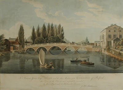
Great Barford Bridge
Barford Bridge was originally built in the 15th Century. It is a beautiful red brick bridge and spans 17 arches and is Grade 1 listed. It was rebuilt from its original limestone and sandstone in 1818 and significantly widened.
Eaton Socon Rivermill Tavern
Eaton Socon was originally part of Bedfordshire and was listed in the Domesday Book as Eaton. The River Mill Tavern is a beautiful old mill building now the home of a friendly riverside pub.
St Neots
St Neots is a charming riverside town which received its market town charter in 1130. St Neots boasts a large Camping and Caravanning Club adjacent to the banks of the River and also has a riverside park with family-run café Ambience Café. The town is named after Cornish Monk Saint Neots from the namesake on Bodmin Moor. It was voted the 4th best place for foodies in 2013 by the Daily Telegraph.
Further Downstream
We have not yet listed history further down the River Great Ouse although our multi-day paddles take you on to Huntingdon, St Ives, and eventually Kings Lynn. During the 1600s the new and old Bedford River was built to improve the trade connections. The River is joined by one of its most famous tributaries The River Cam further downstream. At the time the River Great Ouse was a significant trade route and over the years has seen lace, food produce such as Sugar Beet and other resources shipped.
In 1713 there a major failure of the Denver Sluice which resulted in flooding and this wasn’t rectified until 1750. Now the river course can be explored using either the New Bedford River (a straight cut between Erith and Denver) or the Old Bedford River following the original route.
Would you like to visit some of these historic places?
We offer canoe & kayak hire and trips along the Great River Ouse. Click to contact us for more information.